


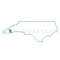
Voting District SAV, Jackson County, North Carolina
About
Outline

Summary
| Unique Area Identifier | 640537 |
| Name | Voting District SAV |
| County | Jackson County |
| State | North Carolina |
| Area (square miles) | 23.35 |
| Land Area (square miles) | 23.35 |
| Water Area (square miles) | 0.00 |
| % of Land Area | 100.00 |
| % of Water Area | 0.00 |
| Latitude of the Internal Point | 35.27491760 |
| Longtitude of the Internal Point | -83.27051850 |
Maps


Graphs
Select a template below for downloading or customizing gragh for Voting District SAV, Jackson County, North Carolina


Neighbors
Neighoring Voting District (by Name) Neighboring Voting District on the Map
- Voting District 06, Macon County, NC
- Voting District 15, Macon County, NC
- Voting District CUL, Jackson County, NC
- Voting District GCK, Jackson County, NC
- Voting District WEB, Jackson County, NC
Top 10 Neighboring County Subdivision (by Population) Neighboring County Subdivision on the Map
- Cullowhee township, Jackson County, NC (9,428)
- Millshoal township, Macon County, NC (2,802)
- Webster township, Jackson County, NC (2,686)
- Cowee township, Macon County, NC (2,273)
- Savannah township, Jackson County, NC (1,495)
- Greens Creek township, Jackson County, NC (1,429)
Top 10 Neighboring Unified School District (by Population) Neighboring Unified School District on the Map
Top 10 Neighboring State Legislative District Lower Chamber (by Population) Neighboring State Legislative District Lower Chamber on the Map
Top 10 Neighboring State Legislative District Upper Chamber (by Population) Neighboring State Legislative District Upper Chamber on the Map
Top 10 Neighboring 111th Congressional District (by Population) Neighboring 111th Congressional District on the Map
Top 10 Neighboring Census Tract (by Population) Neighboring Census Tract on the Map
- Census Tract 9506, Jackson County, NC (10,568)
- Census Tract 9505, Jackson County, NC (5,488)
- Census Tract 9704, Macon County, NC (3,924)
- Census Tract 9701, Macon County, NC (2,684)